|
Size: 1070
Comment:
|
Size: 1037
Comment:
|
| Deletions are marked like this. | Additions are marked like this. |
| Line 7: | Line 7: |
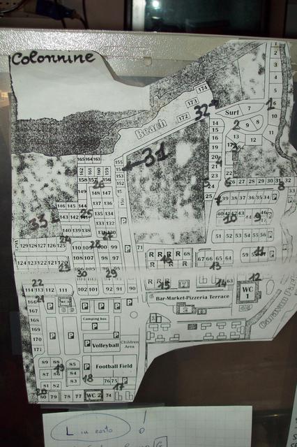
| http://maps.google.it/maps/ms?hl=it&gl=it&ptab=2&ie=UTF8&oe=UTF8&msa=0&msid=102163358171818030455.0004813a6dad2d93243fc&t=h&z=17 | * http://maps.google.it/maps/ms?hl=it&gl=it&ptab=2&ie=UTF8&oe=UTF8&msa=0&msid=102163358171818030455.0004813a6dad2d93243fc&t=h&z=17 |
| Line 9: | Line 9: |
| {{attachment:powermapthumb.jpg}} | * http://www.gpsvisualizer.com/display/data/1268036431-07653-78.29.250.237.html |
| Line 11: | Line 11: |
| [[attachment:powermap.jpg]] | [[attachment:powermap.jpg|{{attachment:powermapthumb.jpg}}]] |
| Line 13: | Line 13: |
| [[attachment:PowerPlugs.gpx]] | |
| Line 17: | Line 16: |
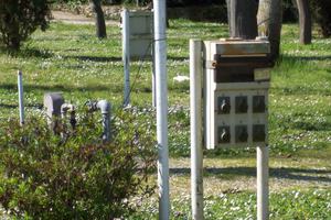
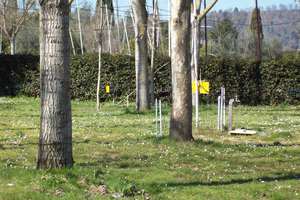
| [[attachment:samplepowercolumn.jpg|{{attachment:thumb_samplepowercolumn.jpg||width=300}}]] [[attachment:treesandplugsites.jpg|{{attachment:thumb_treesandplugsites.jpg||width=300}}]] |
[[attachment:A_SIGN.jpg|{{attachment:thumb_A_SIGN.jpg}}]] [[attachment:B_SIGN.jpg|{{attachment:thumb_B_SIGN.jpg}}]] [[attachment:B_SIGN.jpg|{{attachment:thumb_C_SIGN.jpg}}]] [[attachment:E_SIGN.jpg|{{attachment:thumb_E_SIGN.jpg}}]] |
| Line 20: | Line 21: |
| [[attachment:A_SIGN.jpg|{{attachment:thumb_A_SIGN.jpg||width=600}}]] [[attachment:B_SIGN.jpg|{{attachment:thumb_B_SIGN.jpg||width=600}}]] [[attachment:B_SIGN.jpg|{{attachment:thumb_C_SIGN.jpg||width=600}}]] [[attachment:E_SIGN.jpg|{{attachment:thumb_E_SIGN.jpg||width=600}}]] |
[[attachment:samplepowercolumn.jpg|{{attachment:thumb_samplepowercolumn.jpg}}]] [[attachment:treesandplugsites.jpg|{{attachment:thumb_treesandplugsites.jpg}}]] |
| Line 29: | Line 29: |
| == OpenStreet Maps data == == GPS informations == |
|
| Line 35: | Line 31: |
| [[attachment:blueplug.jpg]] Camping (blue) plug 3 pin 220V | [[attachment:blueplug.jpg|{{attachment:thumb_blueplug.jpg}}]] Camping (blue) plug 3 pin 220V |
Map
This page is dedicated to the site map of the camping for the WBMv3
Contents
Map
JPG
GPX data
PowerPlugs.gpx Trk_10-03-07_13-13-17.xml


